


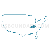
Bluegrass Area Development District (Central)--Lexington-Fayette County (Central) PUMA, Kentucky
About
Outline
--Lexington-Fayette+County+(Central)+PUMA%2c+Kentucky_A280.png)
Summary
| Unique Area Identifier | 192975 |
| Name | Bluegrass Area Development District (Central)--Lexington-Fayette County (Central) PUMA |
| State | Kentucky |
| Area (square miles) | 27.85 |
| Land Area (square miles) | 27.55 |
| Water Area (square miles) | 0.30 |
| % of Land Area | 98.92 |
| % of Water Area | 1.08 |
| Latitude of the Internal Point | 38.03093480 |
| Longtitude of the Internal Point | -84.50678550 |
Maps
--Lexington-Fayette+County+(Central)+PUMA in Kentucky.png)
Graphs
Select a template below for downloading or customizing gragh for Bluegrass Area Development District (Central)--Lexington-Fayette County (Central) PUMA, Kentucky
--Lexington-Fayette+County+(Central)+PUMA%2c+Kentucky_T0.png)
--Lexington-Fayette+County+(Central)+PUMA%2c+Kentucky_T1.png)
--Lexington-Fayette+County+(Central)+PUMA%2c+Kentucky_T2.png)
--Lexington-Fayette+County+(Central)+PUMA%2c+Kentucky_T3.png)
--Lexington-Fayette+County+(Central)+PUMA%2c+Kentucky_T4.png)
--Lexington-Fayette+County+(Central)+PUMA%2c+Kentucky_T5.png)
--Lexington-Fayette+County+(Central)+PUMA%2c+Kentucky_T6.png)
--Lexington-Fayette+County+(Central)+PUMA%2c+Kentucky_T7.png)
--Lexington-Fayette+County+(Central)+PUMA%2c+Kentucky.png)
Neighbors
Neighoring Public Use Microdata Area (by Name) Neighboring Public Use Microdata Area on the Map
Top 10 Neighboring County (by Population) Neighboring County on the Map
Top 10 Neighboring County Subdivision (by Population) Neighboring County Subdivision on the Map
- Lexington-Fayette Central CCD, Fayette County, KY (110,761)
- Lexington-Fayette Southeast CCD, Fayette County, KY (69,590)
- Lexington-Fayette Northeast CCD, Fayette County, KY (45,647)
- Lexington-Fayette Southwest CCD, Fayette County, KY (40,943)
- Lexington-Fayette Northwest CCD, Fayette County, KY (28,862)
Top 10 Neighboring Place (by Population) Neighboring Place on the Map
Top 10 Neighboring Unified School District (by Population) Neighboring Unified School District on the Map
Top 10 Neighboring State Legislative District Lower Chamber (by Population) Neighboring State Legislative District Lower Chamber on the Map
- State House District 62, KY (58,232)
- State House District 45, KY (50,581)
- State House District 88, KY (49,790)
- State House District 77, KY (48,639)
- State House District 76, KY (44,546)
- State House District 56, KY (43,948)
- State House District 75, KY (41,422)
- State House District 79, KY (38,306)
Top 10 Neighboring State Legislative District Upper Chamber (by Population) Neighboring State Legislative District Upper Chamber on the Map
- State Senate District 7, KY (128,013)
- State Senate District 13, KY (115,700)
- State Senate District 12, KY (115,570)
Top 10 Neighboring 111th Congressional District (by Population) Neighboring 111th Congressional District on the Map
Top 10 Neighboring Census Tract (by Population) Neighboring Census Tract on the Map
- Census Tract 42.08, Fayette County, KY (7,097)
- Census Tract 32.02, Fayette County, KY (6,218)
- Census Tract 38.04, Fayette County, KY (6,131)
- Census Tract 34.05, Fayette County, KY (5,940)
- Census Tract 20.01, Fayette County, KY (5,803)
- Census Tract 42.04, Fayette County, KY (5,760)
- Census Tract 30, Fayette County, KY (5,661)
- Census Tract 23.02, Fayette County, KY (5,199)
- Census Tract 26, Fayette County, KY (4,992)
- Census Tract 19, Fayette County, KY (4,767)
Top 10 Neighboring 5-Digit ZIP Code Tabulation Area (by Population) Neighboring 5-Digit ZIP Code Tabulation Area on the Map
- 40517, KY (35,227)
- 40509, KY (32,364)
- 40511, KY (31,798)
- 40503, KY (28,003)
- 40505, KY (26,040)
- 40502, KY (25,709)
- 40504, KY (25,655)
- 40508, KY (23,569)
- 40513, KY (10,994)
- 40506, KY (2,802)